看起來你不是TradeKey.com的會員。 立即註冊,與全球超過7百萬的進口商和出口商建立聯繫。 点击注册--免费! |
BOOK A CALL
Book Call On Your Favorite Time
Code
🗘

By Signing Up. I agree to TradeKey.com Terms of Use, Privacy Policy, IPR and receive emails related to our services

Contact Us
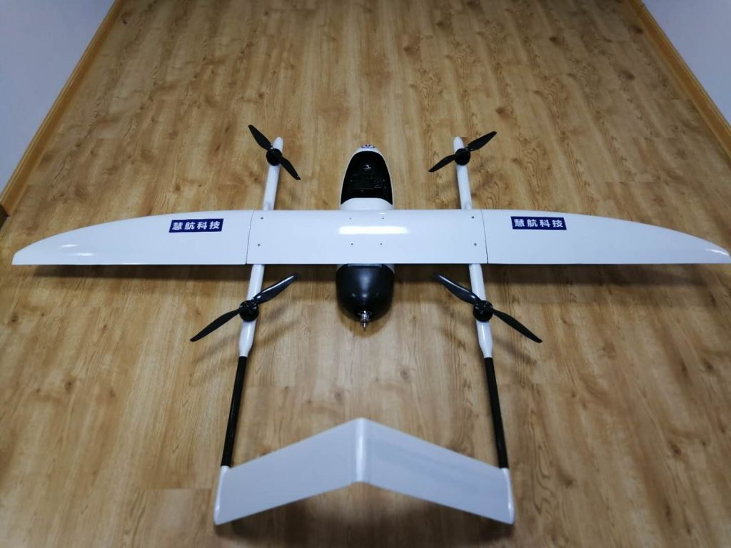
sell China ultralight aircraft Long Range UAV Drone with Camera for Aerial Photography Mapping and Surveying

sell China ultralight aircraft Long Range UAV Drone with Camera for Aerial Photography Mapping and Surveying

离岸价格

获取最新报价

( Negotiable )

|

Minimum Order

位置:

-

最小订单价格:

-

最小订单:

1 Set

包装细节:

alumiinium case. We can pack based on customers' request.

交货时间:

in 4 weeks after order confirmation.

供应能力:

1000 Set per Year

付款方式:

T/T, L/C

现在联系

联系人 Ms. Belinda

Rm401,Block C-5, Ganjingzi District, Dalian, Liaoning

现在联系

详情

Application: aerial mapping, police monitoring, power monitoring and marine monitoring.


I. Performance parameter
 

Wing Span***0mm length of UAV***0mm
Max takeoff weight:*0kg Payload2kg
Empty weight4kg Max flight time2h
Flight radius*0km Max Altitude***0m
Max flight speed**0km/h Cruising speed*0km/h
 Takeoff and landing type: vertical                    Wind loading rating: *0m/s
  Control precision:0.*5m                                Environmental temperature:**0ºC~*0ºC


II. Product features

i. Simple structure: body segment assembly, easy installation, simple operation, more than *0% of the whole machine using composite materials, lightweight design, increase the load factor.

ii. Vertical take-off and landing: no landing space and airspace requirements, high efficiency. The four-axis reinforced fixed-wing composite structure, focusing on solving the fixed-wing aircraft takes off splashes need special runway and venue issues.

iii. RTK positioning: fixed-point landing, precision operation.

iv. Equipped with a portable ground control station, the control software can be used to monitor the UAV\'s flight and operation status through the wireless data link in real time, and flexibly control the UAV\'s operational flights.

v. Autonomous flight: a key take off, safe and convenient.

vi. Aviation-class reliability: Complete system monitoring warnings and emergency management logic. Equipped with self-developed route planning software, and quickly generate optimized flight shooting documents and mission reports.

vii. Professional multispectral, hyper spectral camera and digital camera with a dedicated gesture stable PTZ, which can effectively control the image of the gesture, so that the aerial survey within the allowable error.

viii. aircraft wind resistance, in the 6 wind weather conditions stable operation. sell China ultralight aircraft Long Range UAV Drone with Camera for Aerial Photography Mapping and Surveying

Send a direct inquiry to this supplier

至:

Ms. Belinda < Dalian Huihang Science and Technology Development Co., Ltd. >

我想知道: